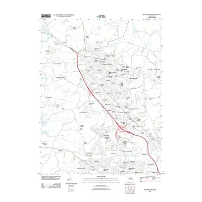
2011 Map of Reisterstown
USGS Topo · Published 2011About this map
Reisterstown and Owings Mills serve as the primary hubs in this suburban Maryland landscape, where the transition from agricultural roots to modern residential development is clearly visible. The area is marked by a dense concentration of historical and religious sites, including the Maryland National Veterans Cemetery and several significant burial grounds such as Oheb Shalom Cemetery and Saint Lukes Cemetery. The western edge of the sheet is dominated by the waters of Liberty Lake and the unique serpentine barrens of Soldiers Delight, home to the Soldiers Delight Mine. To the northeast, the terrain opens into the expansive Worthington Valley, framed by Councilmans Run and Waterspout Run. Established communities like Glyndon and Emory Grove maintain their distinct identities amidst newer neighborhoods like Worthington Meadows and Sagamore Forest, illustrating the steady growth of Baltimore County during the early 21st century.
Find a feature on this map
245 named features on this map. Tap any name to fly to it.
Don’t see what you’re looking for? This feature index may not catch every label — zoom into the map to look around manually.
Map Details
Editions of this 2011 Reisterstown Map
This is the sole edition of this map. No revisions or reprints were ever made.
Other maps of this area

1892 · Ellicott
USGS Topo · 1:62,500

1894 · Ellicott
USGS Topo · 1:62,500

1894 · Baltimore
USGS Topo · 1:62,500

1899 · Baltimore
USGS Topo · 1:62,500

1900 · Parkton
USGS Topo · 1:62,500

1902 · Parkton
USGS Topo · 1:62,500

1904 · Baltimore
USGS Topo · 1:62,500

1905 · Westminster
USGS Topo · 1:62,500

1906 · Ellicott
USGS Topo · 1:62,500

1908 · Patapsco
USGS Topo · 1:125,000