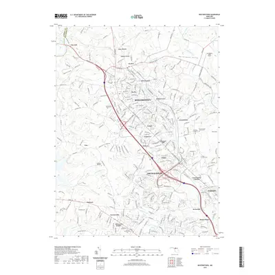
2019 Map of Reisterstown
USGS Topo · Published 2019About this map
The suburban development of northwestern Baltimore County is clearly delineated by the transport arteries of Reisterstown Rd and Owings Mills Blvd. In this 2019 landscape, established communities like Reisterstown and Owings Mills are surrounded by a cluster of smaller settlements including Delight, Glyndon, and Harrisonville. The map highlights a significant concentration of memorial sites and heritage locations, such as the Garrison Forest Veterans Cem, Oheb Shalom Memorial Park, and the Har Sinai Congregation Cem. Natural features like the sprawling Soldiers Delight area and the waters of Gwynns Falls and Jones Falls provide a counterpoint to the dense residential and commercial grid. To the northeast, the Worthington Valley Airport sits within the open terrain of Worthington Valley, while the institutions of McDonogh and Mount Wilson occupy the southeastern quadrant.
Find a feature on this map
61 named features on this map. Tap any name to fly to it.
Don’t see what you’re looking for? This feature index may not catch every label — zoom into the map to look around manually.
Map Details
Editions of this 2019 Reisterstown Map
This is the sole edition of this map. No revisions or reprints were ever made.
Other maps of this area

1892 · Ellicott
USGS Topo · 1:62,500

1894 · Ellicott
USGS Topo · 1:62,500

1894 · Baltimore
USGS Topo · 1:62,500

1899 · Baltimore
USGS Topo · 1:62,500

1900 · Parkton
USGS Topo · 1:62,500

1902 · Parkton
USGS Topo · 1:62,500

1904 · Baltimore
USGS Topo · 1:62,500

1905 · Westminster
USGS Topo · 1:62,500

1906 · Ellicott
USGS Topo · 1:62,500

1908 · Patapsco
USGS Topo · 1:125,000