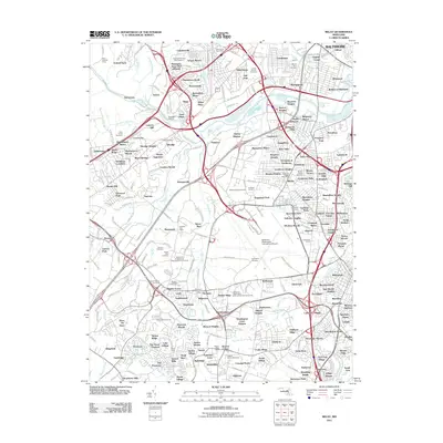
2011 Map of Relay
USGS Topo · Published 2011About this map
The Thomas Viaduct and the surrounding terrain of the Patapsco River valley characterize this portion of Maryland just southwest of Arbutus. The landscape is a dense network of residential communities and critical infrastructure, where established settlements like Relay and Elkridge sit alongside 21st-century developments. The topography is defined by the winding river and its tributaries, including Deep Run and Stony Run, which have historically dictated the layout of transportation corridors and local boundaries.
Find a feature on this map
279 named features on this map. Tap any name to fly to it.
Don’t see what you’re looking for? This feature index may not catch every label — zoom into the map to look around manually.
Map Details
Editions of this 2011 Relay Map
This is the sole edition of this map. No revisions or reprints were ever made.
Other maps of this area

1892 · Laurel
USGS Topo · 1:62,500

1892 · Ellicott
USGS Topo · 1:62,500

1894 · Ellicott
USGS Topo · 1:62,500

1894 · Laurel
USGS Topo · 1:62,500

1894 · Baltimore
USGS Topo · 1:62,500

1894 · Relay
USGS Topo · 1:62,500

1897 · Laurel
USGS Topo · 1:62,500

1899 · Baltimore
USGS Topo · 1:62,500

1904 · Baltimore
USGS Topo · 1:62,500

1906 · Ellicott
USGS Topo · 1:62,500