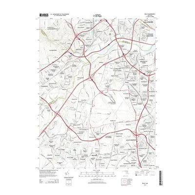
2014 Map of Relay
USGS Topo · Published 2014About this map
The Thomas Viaduct anchors the historic transit corridor where the Patapsco River defines the border between Baltimore and Howard counties. This 2014 survey captures a landscape defined by its deep historical roots and modern infrastructure, centered on the community of Relay. Genealogists will find a high density of burial sites across this terrain, ranging from the large Arbutus Memorial Park Cem and United Hebrew Cem to smaller, family-oriented grounds like the Boyer Burial Ground and Griffith Family Cem. The map illustrates the convergence of historic residential enclaves like Lawyers Hill and Avalon with the massive footprint of the Baltimore/Washington International Thurgood Marshall Airport. Waterways such as Deep Run, Stony Run, and Sawmill Creek weave through suburban developments like Greenbriar Sandalwood and Timber Ridge, marking the drainage patterns of the Piedmont plateau as it nears the Chesapeake Bay drainage.
Find a feature on this map
179 named features on this map. Tap any name to fly to it.
Don’t see what you’re looking for? This feature index may not catch every label — zoom into the map to look around manually.
Map Details
Editions of this 2014 Relay Map
This is the sole edition of this map. No revisions or reprints were ever made.
Other maps of this area

1892 · Laurel
USGS Topo · 1:62,500

1892 · Ellicott
USGS Topo · 1:62,500

1894 · Ellicott
USGS Topo · 1:62,500

1894 · Laurel
USGS Topo · 1:62,500

1894 · Baltimore
USGS Topo · 1:62,500

1894 · Relay
USGS Topo · 1:62,500

1897 · Laurel
USGS Topo · 1:62,500

1899 · Baltimore
USGS Topo · 1:62,500

1904 · Baltimore
USGS Topo · 1:62,500

1906 · Ellicott
USGS Topo · 1:62,500