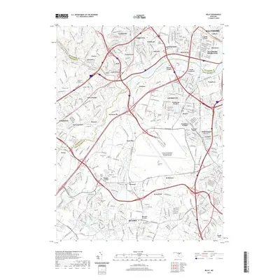
2019 Map of Relay
USGS Topo · Published 2019About this map
The Patapsco River valley serves as the central corridor for this 2019 survey, tracing the intricate boundaries where Baltimore, Howard, and Anne Arundel counties meet. The landscape is a dense network of suburban residential communities such as Arbutus, Linthicum, and Elkridge, interconnected by major transit routes and the historic B & O RR. A significant portion of the area is occupied by the modern footprint of the Baltimore/Washington International Airport Thurgood Marshall, yet traditional landmarks remain, including the structural legacy of the Thomas Viaduct and numerous established burial sites like the United Hebrew Cem and Arbutus Memorial Park. The map captures the continued relevance of old settlements like Relay and Saint Denis, which developed at critical junctions of the river and rail, while showing the extensive trails of the Grist Mill Trail and Ridge Trail winding through the river valley parks.
Find a feature on this map
86 named features on this map. Tap any name to fly to it.
Don’t see what you’re looking for? This feature index may not catch every label — zoom into the map to look around manually.
Map Details
Editions of this 2019 Relay Map
This is the sole edition of this map. No revisions or reprints were ever made.
Other maps of this area

1892 · Laurel
USGS Topo · 1:62,500

1892 · Ellicott
USGS Topo · 1:62,500

1894 · Ellicott
USGS Topo · 1:62,500

1894 · Laurel
USGS Topo · 1:62,500

1894 · Baltimore
USGS Topo · 1:62,500

1894 · Relay
USGS Topo · 1:62,500

1897 · Laurel
USGS Topo · 1:62,500

1899 · Baltimore
USGS Topo · 1:62,500

1904 · Baltimore
USGS Topo · 1:62,500

1906 · Ellicott
USGS Topo · 1:62,500