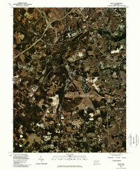
1981 Map of Relay
USGS Topo · Published 1986About this map
The Patapsco River carves through this early 1980s landscape, serving as a natural boundary between the expanding industrial and residential corridors south of Baltimore. The orthophoto format provides a clear aerial perspective of the massive infrastructure at the Baltimore Washington International Airport, which dominates the central portion of the quadrangle. Surrounding the airfield, suburban growth is evident in established communities like Linthicum Heights and Ferndale. The transit network is a primary focus, anchored by the Baltimore Washington Parkway and the historic junction at Relay. This survey documents the area as it transitioned into a major mid-Atlantic transportation hub, recording the footprint of residential neighborhoods in Glen Burnie and Halethorpe before further late-century development.
Find a feature on this map
11 named features on this map. Tap any name to fly to it.
Don’t see what you’re looking for? This feature index may not catch every label — zoom into the map to look around manually.
Map Details
Editions of this 1981 Relay Map
This is the sole edition of this map. No revisions or reprints were ever made.
Other maps of this area

1892 · Laurel
USGS Topo · 1:62,500

1892 · Ellicott
USGS Topo · 1:62,500

1894 · Ellicott
USGS Topo · 1:62,500

1894 · Laurel
USGS Topo · 1:62,500

1894 · Baltimore
USGS Topo · 1:62,500

1894 · Relay
USGS Topo · 1:62,500

1897 · Laurel
USGS Topo · 1:62,500

1899 · Baltimore
USGS Topo · 1:62,500

1904 · Baltimore
USGS Topo · 1:62,500

1906 · Ellicott
USGS Topo · 1:62,500