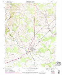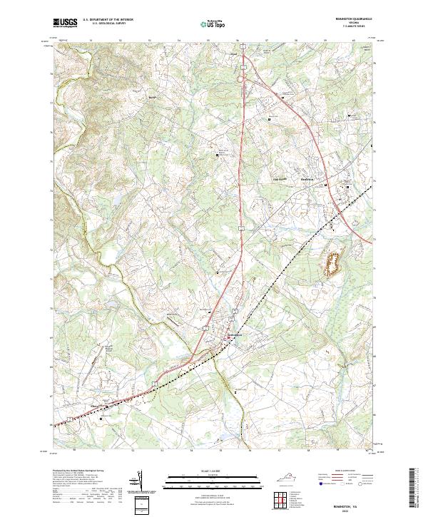
2022 Map of Remington
USGS Topo · Published 2022About this map
The Rappahannock River defines the winding boundary between Fauquier and Culpeper Counties, serving as the central geographic feature of this Northern Virginia landscape. The town of Remington serves as a focal point where the Norfolk Southern railroad line crosses the river, a corridor of commerce that links the area to Bealeton and Opal. The land is characterized by numerous small tributaries such as Marsh Run, Tinpot Run, and Hubbard Run, which drain into the main river channel as it moves toward the Culpeper Basin.
Find a feature on this map
110 named features on this map. Tap any name to fly to it.
Don’t see what you’re looking for? This feature index may not catch every label — zoom into the map to look around manually.
Map Details
Editions of this 2022 Remington Map
This is the sole edition of this map. No revisions or reprints were ever made.