Loading...
Loading map...2023 Map of Richland
USGS Topo · Published 2023About this map
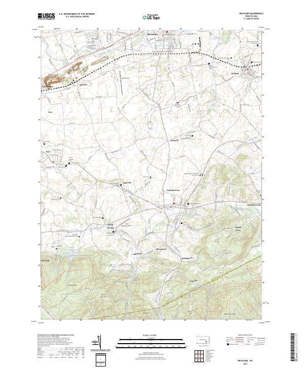
The Furnace Hills and Black Oak Ridge define the southern landscape of this Lebanon County region, where the Lebanon Co Lancaster Co boundary line follows the crests of the high ground. This area is heavily marked by its religious and genealogical heritage, particularly within the Mennonite community. Small family burial sites and denominational landmarks like the Schenck Family Graveyard, Old Krall's Mennonite Church Cem, and Royers Meeting House Cem are scattered across the valley.
Find a feature on this map
74 named features on this map. Tap any name to fly to it.
Don’t see what you’re looking for? This feature index may not catch every label — zoom into the map to look around manually.
Map Details
Date Portrayed2023
Date Published2023
PublisherU.S. Geological Survey
Map TypeTopographic
Scale1:24000
Physical Dimensions24 x 29 inches
Editions of this 2023 Richland Map
This is the sole edition of this map. No revisions or reprints were ever made.
Historical Maps of Canaan Grove Through Time
Featured Locations
Source Details
SourceU.S. Geological Survey
CopyrightPublic Domain