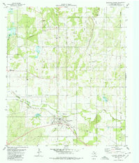
1979 Map of Richland Springs
USGS Topo · Published 1980About this map
Richland Springs serves as the central hub of this Central Texas landscape during the late 1970s, situated at the intersection of the Atchison Topeka and Santa Fe railroad and local ranching routes. The area is defined by a network of drainage systems like Richland Springs Creek and Lick Creek, which carve through prominent elevations such as Locker Hill and the Shiloh Mountain Chain.
Find a feature on this map
24 named features on this map. Tap any name to fly to it.
Don’t see what you’re looking for? This feature index may not catch every label — zoom into the map to look around manually.
Map Details
Editions of this 1979 Richland Springs Map
This is the sole edition of this map. No revisions or reprints were ever made.
Other maps of this area

1885 · San Saba
USGS Topo · 1:125,000

1894 · Brady
USGS Topo · 1:125,000

1894 · San Saba
USGS Topo · 1:125,000

1925 · San Saba 2-a
USGS Topo · 1:48,000

1925 · Brady 1-a
USGS Topo · 1:48,000

1925 · San Saba 2-b
USGS Topo · 1:48,000

1928 · Mercury
USGS Topo · 1:62,500

1930 · Richland Springs
USGS Topo · 1:62,500

1948 · Richland Springs
USGS Topo · 1:62,500

1950 · Mercury
USGS Topo · 1:62,500