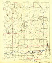
1927 Map of Riverdale
USGS Topo · Published 1942About this map
Riverdale serves as the primary hub of this 1920s Central Valley landscape, situated at the intersection of early automotive routes and the Southern Pacific railroad. The map illustrates a complex hydraulic environment where the Kings River and its various distributaries, including Murphy Slough and Crooked Slough, have been heavily managed for agriculture through systems like the South Br Island Canal. This infrastructure supported a network of rural settlements and rail stops such as Camden, Clint, and Cornwell.
Find a feature on this map
28 named features on this map. Tap any name to fly to it.
Don’t see what you’re looking for? This feature index may not catch every label — zoom into the map to look around manually.
Map Details
Editions of this 1927 Riverdale Map
2 editions found
Other maps of this area

1924 · Riverdale
USGS Topo · 1:31,680

1924 · Conejo
USGS Topo · 1:31,680

1925 · Raisin
USGS Topo · 1:31,680

1925 · Caruthers
USGS Topo · 1:31,680

1926 · Hanford
USGS Topo · 1:31,680

1926 · Lethent
USGS Topo · 1:31,680

1927 · Laton
USGS Topo · 1:31,680

1927 · Burrel
USGS Topo · 1:31,680

1927 · Riverdale
USGS Topo · 1:31,680

1927 · Lemoore
USGS Topo · 1:31,680