2022 Map of Robbins
USGS Topo · Published 2022About this map
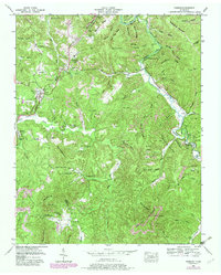
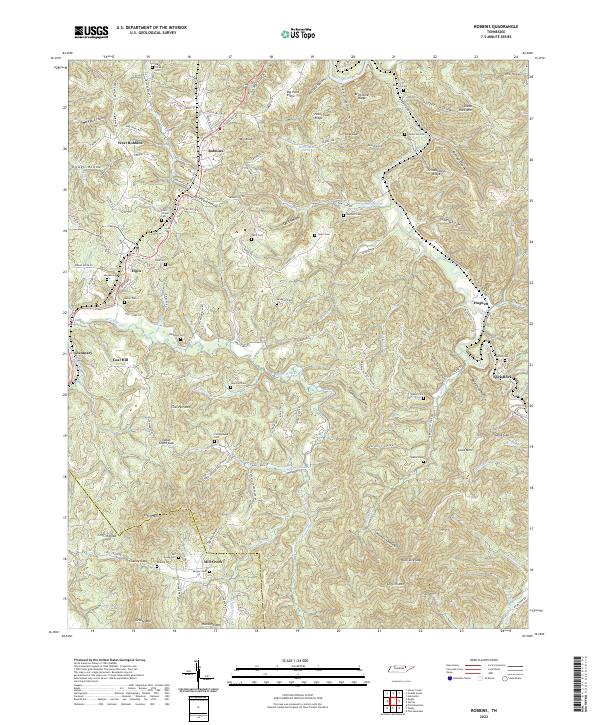
The Southern railroad corridor dictates the settlement pattern of this Tennessee landscape, threading through the communities of Robbins, West Robbins, Elgin, and Glenmary. The terrain is defined by deep incisions like Brickyard Hollow and Oilwell Hollow, reflecting an industrial history tied to extraction and manufacturing. Numerous family and community burial grounds, including the Lewallen, Sexton, and Campground cemeteries, are scattered across the ridges and hollows, providing a dense record of local lineage. In the southern portion of the map, the boundary between Scott and Morgan counties crosses Mill Creek, where landmarks like Chaney and Sumner cemeteries sit near the waters of Mill Creek. The map documents a complex network of named ridges such as Brimstone Ridge and Schoolhouse Ridge, alongside isolated features like Burnt House Spring, which point to earlier homesteads and the rural economy of this Cumberland Plateau region.
Find a feature on this map
145 named features on this map. Tap any name to fly to it.
Don’t see what you’re looking for? This feature index may not catch every label — zoom into the map to look around manually.
Map Details
Editions of this 2022 Robbins Map
This is the sole edition of this map. No revisions or reprints were ever made.