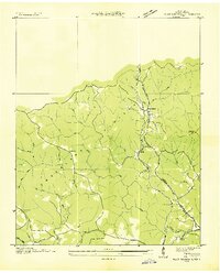
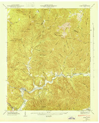
1952 Map of Robbins
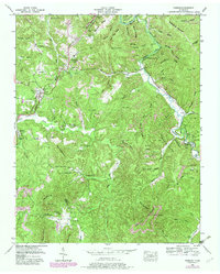
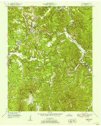
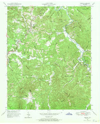
USGS Topo · Published 1980About this map
The Cincinnati New Orleans and Texas Pacific railroad carves a winding path through this portion of the Cumberland Plateau, anchoring settlements like Robbins and Elgin during the mid-twentieth century. The landscape is defined by the extraction economy of the era, visible in the numerous strip mines that follow the contours of Sheep Rock Mountain and Lowe Mountain. In the southern reaches, the boundary of Scott and Morgan Counties crosses through the high ground at Chaney Gap, while the valleys are dotted with local markers of community life, including the Wolf Creek Church and Campground Sch. Significant topographic features like Sawdust Hollow and Bear Cove Hollow drain into the winding New River and Brimstone Creek, showing the traditional orientation of homes and small family burial grounds like Todd Cem and Butler Cem along the creek bottoms.
Find a feature on this map
93 named features on this map. Tap any name to fly to it.
Don’t see what you’re looking for? This feature index may not catch every label — zoom into the map to look around manually.
Map Details
Editions of this 1952 Robbins Map
3 editions found
Other maps of this area

1893 · Briceville
USGS Topo · 1:125,000

1895 · Wartburg
USGS Topo · 1:125,000

1895 · Briceville
USGS Topo · 1:125,000

1896 · Wartburg
USGS Topo · 1:125,000

1896 · Briceville
USGS Topo · 1:125,000

1935 · Gobey
USGS Topo · 1:24,000
1935 · Pilot Mountain
USGS Topo · 1:24,000

1936 · Hogbell Gap
USGS Topo · 1:24,000
1946 · Gobey
USGS Topo · 1:24,000
1946 · Fork Mountain
USGS Topo · 1:24,000