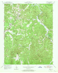
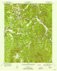
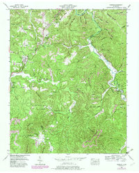
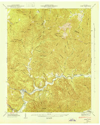
1952 Map of Robbins
USGS Topo · Published 1970About this map
Robbins and the surrounding plateau in Scott and Morgan counties appear here at a peak of extraction and industrial transit in the early 1950s. The landscape is heavily marked by the activity of Strip Mines, which line the ridges above Brimstone Creek and Coal Hill Mountain. This industrial character is further reflected in the Brickyard settlement and the heavy presence of the Southern railroad, which services several sidings and stations including the Rugby Road Sta.
Find a feature on this map
92 named features on this map. Tap any name to fly to it.
Don’t see what you’re looking for? This feature index may not catch every label — zoom into the map to look around manually.
Map Details
Editions of this 1952 Robbins Map
3 editions found
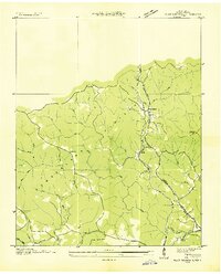
Other maps of this area

1893 · Briceville
USGS Topo · 1:125,000

1895 · Wartburg
USGS Topo · 1:125,000

1895 · Briceville
USGS Topo · 1:125,000

1896 · Wartburg
USGS Topo · 1:125,000

1896 · Briceville
USGS Topo · 1:125,000

1935 · Gobey
USGS Topo · 1:24,000
1935 · Pilot Mountain
USGS Topo · 1:24,000

1936 · Hogbell Gap
USGS Topo · 1:24,000
1946 · Gobey
USGS Topo · 1:24,000
1946 · Fork Mountain
USGS Topo · 1:24,000