
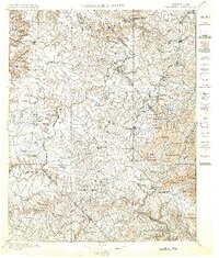
1896 Map of Wartburg
USGS Topo · Published 1896About this map
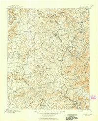
Wartburg and Jamestown anchor this 1890s topography of the Cumberland Plateau, an era when isolated mountain communities were first being connected by heavy rail. The Cincinnati New Orleans and Texas Pacific Railway carves through the eastern ridges, serving settlements like Glenmary and Helenwood. To the west, the Tennessee Central Railroad reaches toward Genesis. The map highlights the utopian experiment at Rugby, along with its rail connection at Elgin (Rugby Road). The landscape is defined by its gaps and fords, such as Wiley Gap, Big Lick Gap, and the crossing at Island Ford. Small mountain hamlets like Deer Lodge, Sunbright, and Armathwaite appear connected by thin trails and wagon roads across the complex drainages of Clear Creek and Yellow Creek, reflecting the difficult logistics of 19th-century life in Morgan and Fentress counties.
Find a feature on this map
154 named features on this map. Tap any name to fly to it.
Don’t see what you’re looking for? This feature index may not catch every label — zoom into the map to look around manually.
Map Details
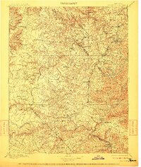
Editions of this 1896 Wartburg Map
6 editions found
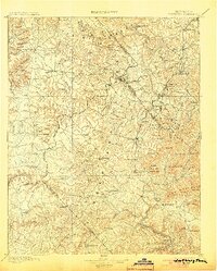
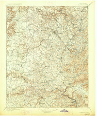
Other maps of this area

1887 · Kingston
USGS Topo · 1:125,000

1890 · Williamsburg
USGS Topo · 1:125,000

1891 · Kingston
USGS Topo · 1:125,000

1892 · Pikeville
USGS Topo · 1:125,000

1893 · Briceville
USGS Topo · 1:125,000

1893 · Kingston
USGS Topo · 1:125,000

1894 · Williamsburg
USGS Topo · 1:125,000

1895 · Wartburg
USGS Topo · 1:125,000

1895 · Loudon
USGS Topo · 1:125,000

1895 · Briceville
USGS Topo · 1:125,000