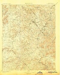
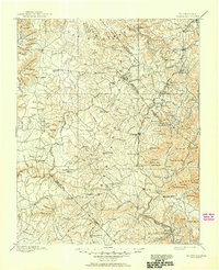
1896 Map of Wartburg
USGS Topo · Published 1903About this map
The Wartburg Plateau dominates this late-19th-century landscape, where the deeply incised valleys of the Obed River and Clear Creek carve through the Cumberland uplift. The settlement pattern reflects the era's utopian and industrial experiments, most notably the English colony at Rugby and the German-founded county seat of Wartburg. Transportation is anchored by the Cincinnati New Orleans and Texas railroad, which skirts the eastern ridges through Glenmary and Elgin (Rugby Road), while long-established river crossings like Leatherwood Ford and Silcott Ford provide vital connections for isolated plateau communities. From the timber-rich hollows of Price Hollow to the high elevations of Bird Mountain, the map documents a transitional period where subsistence mountain farming met the expanding reach of the industrial rail economy.
Find a feature on this map
152 named features on this map. Tap any name to fly to it.
Don’t see what you’re looking for? This feature index may not catch every label — zoom into the map to look around manually.
Map Details
Editions of this 1896 Wartburg Map
6 editions found

Other maps of this area

1887 · Kingston
USGS Topo · 1:125,000

1890 · Williamsburg
USGS Topo · 1:125,000

1891 · Kingston
USGS Topo · 1:125,000

1892 · Pikeville
USGS Topo · 1:125,000

1893 · Briceville
USGS Topo · 1:125,000

1893 · Kingston
USGS Topo · 1:125,000

1894 · Williamsburg
USGS Topo · 1:125,000

1895 · Wartburg
USGS Topo · 1:125,000

1895 · Loudon
USGS Topo · 1:125,000

1895 · Briceville
USGS Topo · 1:125,000