1895 Map of Wartburg
USGS Topo · Published 1895About this map
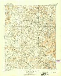
Wartburg and its surrounding Cumberland Plateau landscape appear here in the final decade of the 19th century, characterized by a network of isolated settlements and steep-banked waterways. The map records the early development of Rugby, the utopian colony established by Thomas Hughes, alongside the German-influenced settlement of Allardt. These intentional communities are situated among established mountain towns like Jamestown and Oneida. The rugged geography is defined by the deep incisions of the South Fork of Cumberland River and the Emory River, which dictated the path of the regional rail lines.
Find a feature on this map
116 named features on this map. Tap any name to fly to it.
Don’t see what you’re looking for? This feature index may not catch every label — zoom into the map to look around manually.
Map Details
Editions of this 1895 Wartburg Map
This is the sole edition of this map. No revisions or reprints were ever made.