Old Maps of Fairfield Glade, Tennessee
Explore 46 old maps of Fairfield Glade, spanning from 1887 to today. These high-resolution historic maps reveal how streets, neighborhoods, landmarks, and natural features evolved over time — perfect for genealogy, metal detecting, research, and local history exploration.
What you can do with these maps:
- See how Fairfield Glade changed over time: Compare historical maps to modern-day views to trace roads, homesites, rail lines & more.
- View detailed metadata: Each map includes creators, publishers, year, scale, and archive source.
- Overlay maps with satellite & LiDAR: Visualize the past alongside modern tools to explore terrain & human change.
- Trusted historical sources: Maps sourced from the USGS, Library of Congress, and other archives.
- Access maps your way: View online, download high-res files, or order prints for personal or research use.
Start exploring old maps of Fairfield Glade to uncover forgotten places, hidden landmarks, and the deep history beneath your feet.
Fairfield Glade, TN maps
(46)- 1887 Map of Kingston
 1887 Kingston1887 Print · USGSCentral Tennessee in the late nineteenth century was a world of river landings and new rail lines. Genealogists can trace family roots through riverside sites like Sevier's Ferry or rural hubs like Bogges X Roads and Ten Mile Stand.
 - 1891 Map of Kingston
 1891 Kingston1891 Print · USGSEastern Tennessee in the 1890s reveals a river-driven economy at the edge of the Cumberland Plateau. Genealogists can trace early crossings and landings such as Mc Elwee's Ferry and Pinhook Landing, or locate vanished crossroads like Kemmers Old Stand.2 unique versions available
 - 1893 Map of Kingston, 1905 Print
 1893 Kingston1905 Print · USGSEastern Tennessee at the end of the nineteenth century is a landscape of mountain gaps and vital river landings. Researchers can trace early river crossings like Jackson Ferry, the path of the Cincinnati Southern Railroad, and settlements like Rhea Springs and Kingston.5 unique versions available
 - 1895 Map of Wartburg
 1895 Wartburg1895 Print · USGSThe Cumberland Plateau of the late nineteenth century comes to life through this record of high-country towns and rivers. Genealogists can trace early homesteads and rail stops from Oneida down to Wartburg, including the distinct colonies at Rugby and Allardt.
 - 1896 Map of Wartburg
 1896 Wartburg1896 Print · USGSThe Cumberland Plateau in the late nineteenth century is captured here as railroads began to transform the mountain economy. Trace the development of utopian Rugby, the county seat at Wartburg, and remote crossings like Island Ford or Big Lick Gap.6 unique versions available
 - 1936 Map of Hebbertsburg
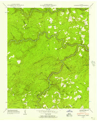
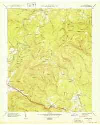
 1936 Hebbertsburg1936 Print · USGSCumberland and Morgan Counties come together in the mid-1930s along the winding Obed River and Daddy Creek. Researchers can locate old community hubs like Hebbertsburg and Frankfort, alongside river crossings at Hegler Ford and Potter Ford.
 - 1936 Map of Fox Creek
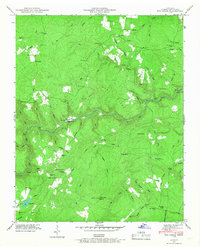
 1936 Fox Creek1936 Print · USGSCumberland County in the mid-1930s shows a landscape of river-tied settlements and rural schools before modern development. Researchers can locate the Peavine Cem, trace the trails around Genesis, or find the river crossing at Potter Ford.
 - 1936 Map of Ozone
 1936 Ozone1936 Print · USGSCumberland County's highland terrain in the mid-1930s reveals a landscape shaped by the Tennessee Central Railroad and early state highways. Genealogists and historians can trace family locations near Waldensia, Ozone, and the Gill Cem.
 - 1936 Map of Dorton
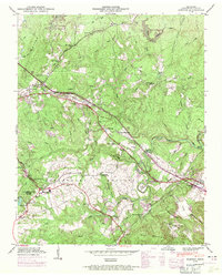
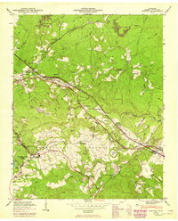
 1936 Dorton1936 Print · USGSCumberland County comes into focus in the mid-1930s as federal projects began reshaping the plateau. Genealogists can trace family footprints at Cumberland Homesteads or locate the site of CCC Camp No 3464 and the Homestead Sch.
 - 1943 Map of Hebbertsburg, 1957 Print
 1943 Hebbertsburg1957 Print · USGSThe Cumberland Plateau landscape near the Morgan and Cumberland county line comes to life in the 1940s. Genealogists and local historians can trace the foundations of mountain life through Frankfort, the New Home Church, and old river crossings like Potter Ford.5 unique versions available
 - 1945 Map of Hebbertsburg
 1945 Hebbertsburg1945 Print · USGSCumberland and Morgan counties appear here in the mid-1940s, where river fords and mountain ridges dictated the pace of rural life. Genealogists and local historians can locate old landmarks like Potter Chapel Sch, Hebbertsburg, and the Pilot Knob Lookout Tower.
 - 1946 Map of Fox Creek, 1968 Print
 1946 Fox Creek1968 Print · USGSCumberland County rural life is captured here in the mid-1940s, centered on the deep gorge of the Obed River. Researchers can trace family sites like Henry Cem, early schools including Slate Springs Sch, and the remote Elmore Gem mine.3 unique versions available
 - 1946 Map of Dorton, 1971 Print
 1946 Dorton1971 Print · USGSCumberland County during the post-war era showcases the fascinating New Deal planning of the Cumberland Homesteads. Genealogists and historians can trace family locations near the Homestead Cem, Baker Chapel, and the tracks of the Tennessee Central railroad.2 unique versions available
 - 1946 Map of Ozone, 1975 Print
 1946 Ozone1975 Print · USGSCumberland County settlement and transport patterns are captured here as the new interstate began to reshape the plateau during the mid-sixties. Genealogists and local historians can trace legacy sites from Ozone to Crab Orchard, including Glade Cem, Old Walton Road, and the Tennessee Central railroad line.2 unique versions available
 - 1949 Map of Ozone
 1949 Ozone1949 Print · USGSCumberland County’s mountain gaps and plateau settlements are captured here in the late 1940s, just as modern highways began to parallel historic pioneer trails. Researchers can trace the path of the Old Walton Road and locate family burial sites like Gill Cem and Millstone Cem.2 unique versions available
 - 1949 Map of Fox Creek
 1949 Fox Creek1949 Print · USGSCumberland County’s high plateau country is shown here in the late Forties as a landscape of isolated homesteads and deep river gorges. Genealogists can locate family landmarks like Henry Cem and Elmore Cem or trace old routes to Genesis and the Potter Ford.
 - 1949 Map of Dorton
 1949 Dorton1949 Print · USGSCumberland County’s plateau landscape is captured here in the mid-century during the development of the Tennessee Central Railroad. Researchers can locate family sites at Turner Cem and Homestead Cem, or trace early community hubs like Dorton Sch and Baker Chapel.2 unique versions available
 - 1953 Map of Chattanooga
 1953 Chattanooga1953 Print · USGSSoutheast Tennessee in the early fifties shows a landscape reshaped by river management and rail power. Trace the rail lines of the Southern Ry through riverside towns or locate the preserved grounds of the Chickamauga and Chattanooga National Military Park.
 - 1956 Map of Corbin, 1966 Print
 1956 Corbin1966 Print · USGSThe Kentucky and Tennessee borderlands are captured here in the mid-fifties, showing the region's shift toward modern interstate travel and reservoir development. Genealogists and historians can trace old community lines near Albany and Monticello or locate early rail junctions along the Southern and Tennessee Central lines.3 unique versions available
 - 1957 Map of Chattanooga, 1966 Print
 1957 Chattanooga1966 Print · USGSEast Tennessee in the mid-1960s shows a landscape of massive hydroelectric reservoirs and emerging industrial sites like the Atomic Energy Commission (Oak Ridge Area). Trace the rail networks of the Southern Ry through Chattanooga or locate family-named ridges across the Cumberland Plateau.3 unique versions available
 - 1958 Map of Corbin
 1958 Corbin1958 Print · USGSThe Upper Cumberland borderlands appear in the late 1950s as massive reservoirs and early atomic-era growth reshape the region. Trace family roots and vanished landmarks near Lake Cumberland, Oak Ridge, and the Cumberland National Forest.
 - 1959 Map of Chattanooga
 1959 Chattanooga1959 Print · USGSSoutheast Tennessee is shown here during a decade of industrial growth and hydroelectric development. Trace the regional rail networks of the Southern Ry and find landmark sites like Lookout Mountain, Fall Creek Falls State Park, and Chattanooga.
 - 1960 Map of Chattanooga
 1960 Chattanooga1960 Print · USGSSoutheast Tennessee and the southern Appalachians are shown here at the height of the river-management era. You can trace the valley rail lines and locate Lookout Mountain and the expansive waters of Chickamauga Reservoir.
 - 1964 Map of Chattanooga
 1964 Chattanooga1964 Print · USGSSoutheast Tennessee and the western Carolinas appear in the mid-sixties as a powerhouse of river-driven industry and mountain wilderness. Genealogists and historians can trace rail-town lineages along the Southern Ry or locate family landmarks near Watts Bar Lake and Tellico Plains.
 - 1979 Map of Oakridge, 1980 Print
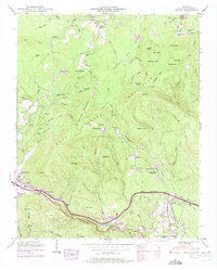
 1979 Oakridge1980 Print · USGSThe eastern Tennessee highlands are captured here in the late 1970s, showcasing a landscape of coal mining and mountain conservation. Genealogists and researchers can locate family landmarks such as Potter Cem, Sunbright Sch, and the historic settlement of Rugby.
Showing maps 1-25 of 46
Top cities near Fairfield Glade
- Crossville historical maps
- Rockwood historical maps
- Crab Orchard historical maps
- Sunbright historical maps
Top neighborhoods of Fairfield Glade
- Dochester historical maps
- Lake Pomeroy historical maps
- Windsor Bluff historical maps
- Peavine historical maps
- Berkshire Forest historical maps
- Wiltshire historical maps
See more
Frequently asked questions
- What are the different types of historical maps available for Fairfield Glade?
- What is the oldest map of Fairfield Glade?
- Where can I purchase historical maps of Fairfield Glade for my home or office?
- Where can I download high-res historical maps of Fairfield Glade?
- Are there historical topographic maps available for Fairfield Glade?
- Is there historical aerial imagery available for Fairfield Glade?
- Where are historical maps of Fairfield Glade sourced from?