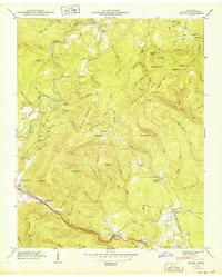
1949 Map of Ozone
USGS Topo · Published 1949About this map
Ozone and the surrounding plateau terrain of the Crab Orchard Mountains are defined by a historic transportation corridor where the Tennessee Central Railroad and Tennessee 1 navigate the high gaps. This 1940s landscape reveals the transition from early pioneer routes to mid-century infrastructure, featuring the Old Walton Road alongside the more modern Broadway of America. The settlement at Crab Orchard serves as a focal point, supported by an Airway Beacon that signals the era's growing aviation needs.
Find a feature on this map
99 named features on this map. Tap any name to fly to it.
Don’t see what you’re looking for? This feature index may not catch every label — zoom into the map to look around manually.
Map Details
Editions of this 1949 Ozone Map
2 editions found
Other maps of this area

1887 · Kingston
USGS Topo · 1:125,000

1891 · Kingston
USGS Topo · 1:125,000

1893 · Kingston
USGS Topo · 1:125,000

1895 · Wartburg
USGS Topo · 1:125,000

1896 · Wartburg
USGS Topo · 1:125,000

1935 · Rockwood
USGS Topo · 1:24,000

1935 · Lancing
USGS Topo · 1:24,000

1936 · Hebbertsburg
USGS Topo · 1:24,000

1936 · Fox Creek
USGS Topo · 1:24,000

1936 · Roddy
USGS Topo · 1:24,000