
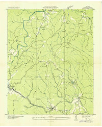
1936 Map of Hebbertsburg
USGS Topo · Published 1936About this map
The boundary between Morgan County and Cumberland County cuts through this high-plateau landscape, where the Obed River and Daddy Creek carve deep courses into the terrain. In 1936, this area remained a network of rural schoolhouse-centered communities such as Hebbertsburg, Frankfort, and Halfway. The reliance on local waterways for transit is evident in the many named river crossings, including Hegler Ford and the Walton Ford Bridge. Small-scale infrastructure like Obed Junction and Bucks Switch point to the vital rail or industrial spurs connecting these settlements to the broader region. For genealogists, the map preserves the exact locations of local landmarks such as the New Hope Cem and several community schools like Potter Chapel Sch and Nealon Sch before mid-century modernization altered the rural fabric.
Find a feature on this map
42 named features on this map. Tap any name to fly to it.
Don’t see what you’re looking for? This feature index may not catch every label — zoom into the map to look around manually.
Map Details
Editions of this 1936 Hebbertsburg Map
This is the sole edition of this map. No revisions or reprints were ever made.
Other maps of this area

1887 · Kingston
USGS Topo · 1:125,000

1891 · Kingston
USGS Topo · 1:125,000

1893 · Kingston
USGS Topo · 1:125,000

1895 · Wartburg
USGS Topo · 1:125,000

1896 · Wartburg
USGS Topo · 1:125,000

1935 · Lancing
USGS Topo · 1:24,000

1935 · Pilot Mountain
USGS Topo · 1:24,000

1936 · Fox Creek
USGS Topo · 1:24,000

1936 · Twin Bridges
USGS Topo · 1:24,000
1936 · Ozone
USGS Topo · 1:24,000