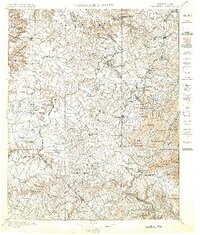
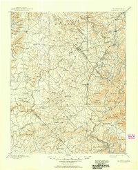
1896 Map of Wartburg
USGS Topo · Published 1896About this map
Wartburg serves as the focal point for this late 19th-century survey of the Cumberland Plateau, where the rugged topography of The Wilderness meets a burgeoning industrial corridor. The Cincinnati New Orleans and Texas Pacific Railway slices through the eastern terrain, connecting settlements like Oneida, Robbins, and Sunbright. This rail line defines the landscape's economic life, bypassing older, more isolated upland communities such as Jamestown and Allardt.
Find a feature on this map
130 named features on this map. Tap any name to fly to it.
Don’t see what you’re looking for? This feature index may not catch every label — zoom into the map to look around manually.
Map Details
Editions of this 1896 Wartburg Map
6 editions found

Other maps of this area

1887 · Kingston
USGS Topo · 1:125,000

1890 · Williamsburg
USGS Topo · 1:125,000

1891 · Kingston
USGS Topo · 1:125,000

1892 · Pikeville
USGS Topo · 1:125,000

1893 · Briceville
USGS Topo · 1:125,000

1893 · Kingston
USGS Topo · 1:125,000

1894 · Williamsburg
USGS Topo · 1:125,000

1895 · Wartburg
USGS Topo · 1:125,000

1895 · Loudon
USGS Topo · 1:125,000

1895 · Briceville
USGS Topo · 1:125,000