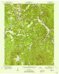
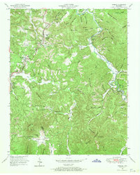
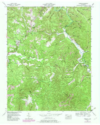
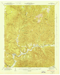
1952 Map of Robbins
USGS Topo · Published 1953About this map
The Brimstone Railroad and the Southern line converge in this rugged section of the Cumberland Plateau, defining a landscape shaped by coal extraction and timber. Extensive Strip Mines mark the ridges above Robbins and Elgin, while numerous small communities like Coal Hill and West Robbins cling to the valley floors and rail sidings. The map reveals a dense network of local institutions, including Love Chapel and the Mt Pleasant School, which served the families working the nearby mines and sawmills. The topographic detail captures the transition from the high Wallace Ridge down to the winding course of the New River and Brimstone Creek. Local aviation is represented by Todd Airfield near the southern edge of the Elgin settlement, providing a look at mid-century infrastructure in Scott County.
Find a feature on this map
52 named features on this map. Tap any name to fly to it.
Don’t see what you’re looking for? This feature index may not catch every label — zoom into the map to look around manually.
Map Details
Editions of this 1952 Robbins Map
3 editions found
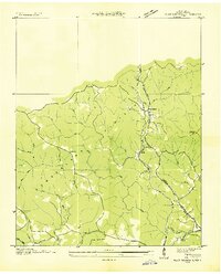
Other maps of this area

1893 · Briceville
USGS Topo · 1:125,000

1895 · Wartburg
USGS Topo · 1:125,000

1895 · Briceville
USGS Topo · 1:125,000

1896 · Wartburg
USGS Topo · 1:125,000

1896 · Briceville
USGS Topo · 1:125,000

1935 · Gobey
USGS Topo · 1:24,000
1935 · Pilot Mountain
USGS Topo · 1:24,000

1936 · Hogbell Gap
USGS Topo · 1:24,000
1946 · Gobey
USGS Topo · 1:24,000
1946 · Fork Mountain
USGS Topo · 1:24,000