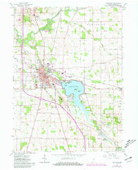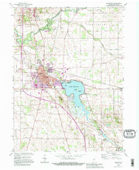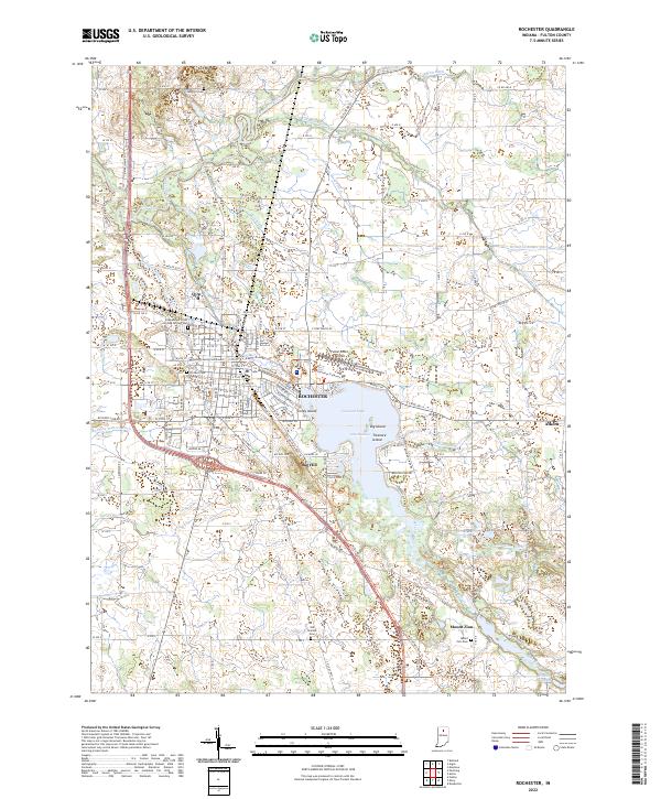
2022 Map of Rochester
USGS Topo · Published 2022About this map
Lake Manitou dominates the central landscape, a significant water body featuring named landforms like Big Island, Treasure Island, and Coney Island. The city of Rochester serves as the focal point of the region, housing the Fulton County Courthouse and serving as a hub for local infrastructure including the Fulton County Airport. The surrounding rural territory is defined by an intricate network of drainage ditches such as McMahan Ditch and Blair Ditch, which channel water toward the Tippecanoe River in the northwest.
Find a feature on this map
135 named features on this map. Tap any name to fly to it.
Don’t see what you’re looking for? This feature index may not catch every label — zoom into the map to look around manually.
Map Details
Editions of this 2022 Rochester Map
This is the sole edition of this map. No revisions or reprints were ever made.
Historical Maps of Indiana Through Time
3 maps found