2022 Map of Rogers
USGS Topo · Published 2022About this map
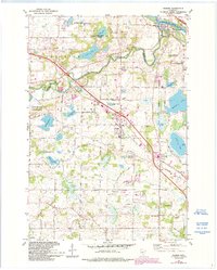
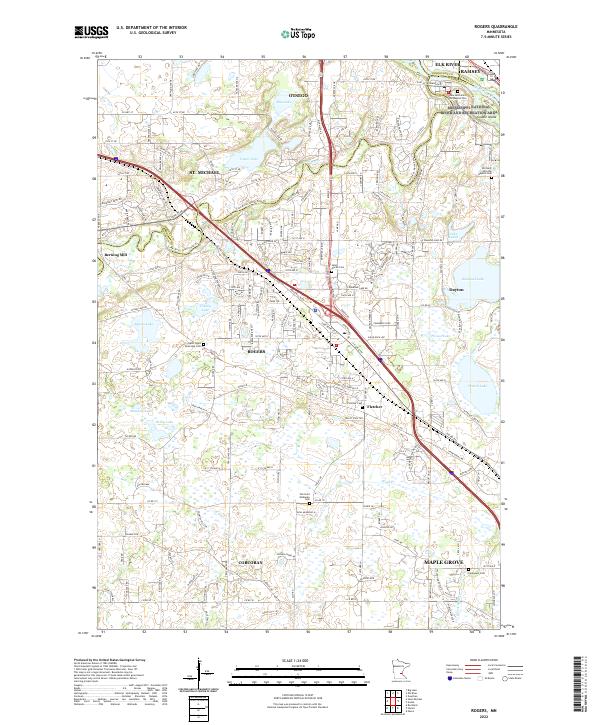
Rogers sits at the center of this 2022 survey, surrounded by a transition from suburban development to the agricultural fields of Corcoran and Otsego. The landscape is defined by its water, from the winding Crow River and Rush Cr to the protected wetlands of the Mississippi National River and Recreation Area in the northeast corner. This modern topographic study captures the contemporary footprint of local communities, while still preserving markers of earlier settlement like Berning Mill and numerous small cemeteries. Cultural and genealogical sites are prominent, including Saint Martin Cem and the Old Saint Walburga Cem. The drainage patterns of Sylvan Lake, Cowley Lake, and Diamond Cr reveal the intricate hydrology of Hennepin County and neighboring Sherburne and Anoka counties.
Find a feature on this map
87 named features on this map. Tap any name to fly to it.
Don’t see what you’re looking for? This feature index may not catch every label — zoom into the map to look around manually.
Map Details
Editions of this 2022 Rogers Map
This is the sole edition of this map. No revisions or reprints were ever made.