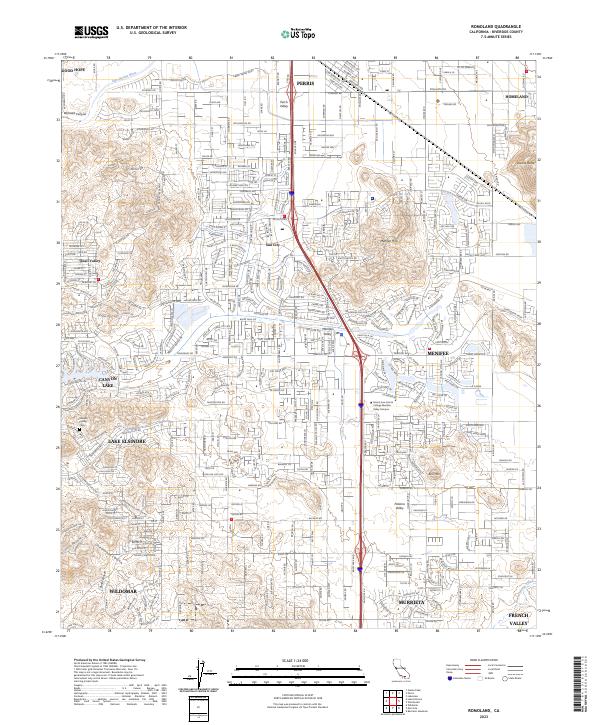
2023 Map of Romoland
USGS Topo · Published 2023About this map
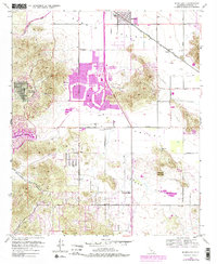
The San Jacinto River cuts across the northern edge of this landscape, framing a region of rapid suburban development and established valleys. Local history is anchored at the Manker Family Cem near Canyon Lake, while the educational heart of the area is centered at the Mount San Jacinto College Menifee Valley Campus. The map illustrates the distinct identities of Sun City and Menifee Valley, showing a complex network of residential streets that have filled the spaces between prominent natural landmarks like Double Butte and Bell Mtn.
Find a feature on this map
381 named features on this map. Tap any name to fly to it.
Don’t see what you’re looking for? This feature index may not catch every label — zoom into the map to look around manually.
Map Details
Editions of this 2023 Romoland Map
This is the sole edition of this map. No revisions or reprints were ever made.