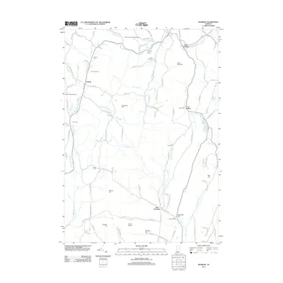
2012 Map of Roxbury
USGS Topo · Published 2012About this map
Roxbury and its surrounding hill country serve as the focal point for this survey of Washington County's upland landscape. The terrain is defined by a series of prominent peaks and ridgelines, including Shaw Mountain and Drinkwater Hill, which dictate the winding paths of the region's transport network. A notable concentration of heritage sites is evident, specifically the Stony Brook Covered Bridge over Stony Brook and several remote burying grounds such as the First Settler Cem and Batchellor-Spaulding Cem.
Find a feature on this map
109 named features on this map. Tap any name to fly to it.
Don’t see what you’re looking for? This feature index may not catch every label — zoom into the map to look around manually.
Map Details
Editions of this 2012 Roxbury Map
This is the sole edition of this map. No revisions or reprints were ever made.
Other maps of this area

1915 · Rochester
USGS Topo · 1:62,500

1917 · Rochester
USGS Topo · 1:62,500

1919 · Royalton
USGS Topo · 1:62,500

1919 · Lincoln Mountain
USGS Topo · 1:62,500

1920 · Lincoln Mountain
USGS Topo · 1:48,000

1921 · Lincoln Mountain
USGS Topo · 1:62,500

1922 · Barre
USGS Topo · 1:48,000

1924 · Barre
USGS Topo · 1:62,500

1924 · Randolph
USGS Topo · 1:48,000

1926 · Randolph
USGS Topo · 1:62,500