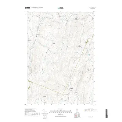
2018 Map of Roxbury
USGS Topo · Published 2018About this map
Roxbury and its surrounding hill country sit at a geographic crossroads where the boundaries of Washington, Addison, and Orange counties converge. The landscape is defined by high ridges like Shaw Mtn and Drinkwater Hill, which separate the various branches of the Dog River and the Third Branch White River. This mountainous terrain dictated the placement of small, disconnected hamlets such as South Northfield, East Roxbury, and West Brookfield, each serving a specific valley or upland pocket.
Find a feature on this map
105 named features on this map. Tap any name to fly to it.
Don’t see what you’re looking for? This feature index may not catch every label — zoom into the map to look around manually.
Map Details
Editions of this 2018 Roxbury Map
This is the sole edition of this map. No revisions or reprints were ever made.
Other maps of this area

1915 · Rochester
USGS Topo · 1:62,500

1917 · Rochester
USGS Topo · 1:62,500

1919 · Royalton
USGS Topo · 1:62,500

1919 · Lincoln Mountain
USGS Topo · 1:62,500

1920 · Lincoln Mountain
USGS Topo · 1:48,000

1921 · Lincoln Mountain
USGS Topo · 1:62,500

1922 · Barre
USGS Topo · 1:48,000

1924 · Barre
USGS Topo · 1:62,500

1924 · Randolph
USGS Topo · 1:48,000

1926 · Randolph
USGS Topo · 1:62,500