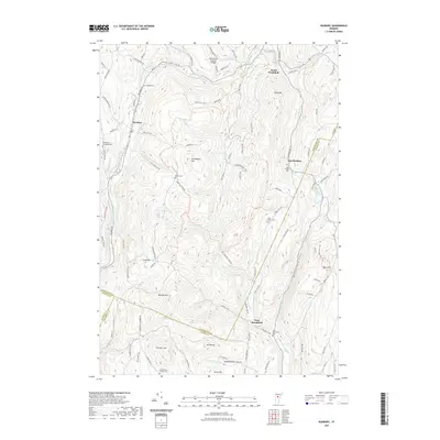
2021 Map of Roxbury
USGS Topo · Published 2021About this map
Roxbury and South Northfield anchor the northern reaches of this central Vermont landscape, where the headwaters of the Dog River begin their northward journey. The terrain is defined by a series of prominent peaks and ridges, including Messier Hill, Drinkwater Hill, and the significant elevation of Cram Hill. This high country serves as a triple-county meeting point for Washington, Orange, and Addison counties, a geographic intersection that has shaped local property lines and road networks for generations.
Find a feature on this map
101 named features on this map. Tap any name to fly to it.
Don’t see what you’re looking for? This feature index may not catch every label — zoom into the map to look around manually.
Map Details
Editions of this 2021 Roxbury Map
This is the sole edition of this map. No revisions or reprints were ever made.
Other maps of this area

1915 · Rochester
USGS Topo · 1:62,500

1917 · Rochester
USGS Topo · 1:62,500

1919 · Royalton
USGS Topo · 1:62,500

1919 · Lincoln Mountain
USGS Topo · 1:62,500

1920 · Lincoln Mountain
USGS Topo · 1:48,000

1921 · Lincoln Mountain
USGS Topo · 1:62,500

1922 · Barre
USGS Topo · 1:48,000

1924 · Barre
USGS Topo · 1:62,500

1924 · Randolph
USGS Topo · 1:48,000

1926 · Randolph
USGS Topo · 1:62,500