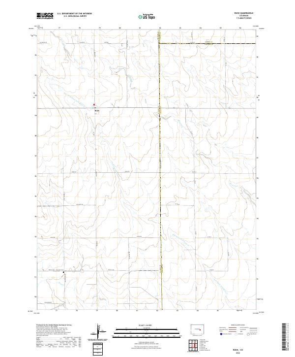
2022 Map of Rush
USGS Topo · Published 2022About this map
Rush sits at a high-plains crossroads where the borders of El Paso, Lincoln, and Elbert counties meet. This 2022 survey details a landscape defined by expansive ranching and dryland farming tracts, crisscrossed by a grid of rural routes like Jacobson Rd and Gieck Rd. The drainage patterns of Steels Fork and its tributaries, including W Br Steels Fork Horse Cr, carve subtle relief into the terrain. For genealogists and local historians, the Crescent Cem south of the main settlement provides a vital point of reference for family research in this eastern Colorado community. The naming of roads after local families, such as Trogilo Rd and Whittemore Rd, reflects the deep-rooted agricultural heritage of the region, where seasonal water sources like Pond Cr remain critical landmarks.
Find a feature on this map
36 named features on this map. Tap any name to fly to it.
Don’t see what you’re looking for? This feature index may not catch every label — zoom into the map to look around manually.
Map Details
Editions of this 2022 Rush Map
This is the sole edition of this map. No revisions or reprints were ever made.
Other maps of this area

1889 · Sanborn
USGS Topo · 1:125,000

1891 · Sanborn
USGS Topo · 1:125,000

1893 · Sanborn
USGS Topo · 1:125,000

1893 · Big Springs
USGS Topo · 1:125,000

1954 · Lamar
USGS Topo · 1:250,000

1954 · Pueblo
USGS Topo · 1:250,000

1957 · Pueblo
USGS Topo · 1:250,000

1958 · Pueblo
USGS Topo · 1:250,000

1958 · Lamar
USGS Topo · 1:250,000

1962 · Pueblo
USGS Topo · 1:250,000