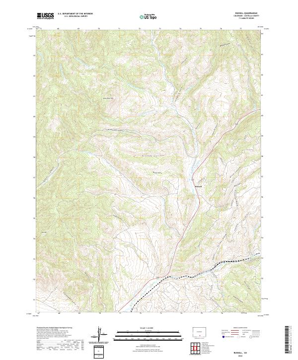
2022 Map of Russell
USGS Topo · Published 2022About this map
Sangre de Cristo Cr flows through the center of this landscape, cutting past the settlement of Russell. The topography is defined by an intricate network of drainages and high points, including Lone Rock Hill and Buck Mtn. Significant watercourses such as Middle Fork Placer Cr and Malo Vega Cr feed into the larger system, while numerous gulches like Bronco-Dan Gulch and Kennedy Gulch carve through the terrain. The road network in the southeastern quadrant, featuring Forbes Park Rd and Wagon Mesa Loop, indicates a transition from the drainage basins toward more developed mountain access. This 2022 survey documents the contemporary names of local canyons and gulches, from Baker Canyon in the west to Coyote Canyon in the south, providing a modern record of the geographic nomenclature in this part of Costilla County.
Find a feature on this map
47 named features on this map. Tap any name to fly to it.
Don’t see what you’re looking for? This feature index may not catch every label — zoom into the map to look around manually.
Map Details
Editions of this 2022 Russell Map
This is the sole edition of this map. No revisions or reprints were ever made.
Other maps of this area

1889 · Huerfano Park
USGS Topo · 1:125,000

1892 · Huerfano Park
USGS Topo · 1:125,000

1954 · Trinidad
USGS Topo · 1:250,000

1955 · Trinidad
USGS Topo · 1:250,000

1958 · Trinidad
USGS Topo · 1:250,000

1959 · Trinidad
USGS Topo · 1:250,000

1963 · Mc Carty Park
USGS Topo · 1:24,000

1963 · La Veta Pass
USGS Topo · 1:24,000

1967 · Mosca Pass
USGS Topo · 1:24,000
1967 · Blanca Peak
USGS Topo · 1:24,000