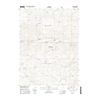
2016 Map of Rustic
USGS Topo · Published 2016About this map
Cache la Poudre River winds through this mountainous terrain in Larimer County, providing the central corridor for the settlements of Glen Echo and Rustic. The landscape is a network of ridges and gulches within the Roosevelt National Forest, where resource extraction and spiritual sites sit side-by-side. Evidence of historical prospecting is found at sites labeled Magnetite and Feldspar, while the area's social history is recorded in numerous small burial grounds, including the Manhattan Cem, Fairkyles Cem, and the uniquely titled Great Stupa Cem.
Find a feature on this map
55 named features on this map. Tap any name to fly to it.
Don’t see what you’re looking for? This feature index may not catch every label — zoom into the map to look around manually.
Map Details
Editions of this 2016 Rustic Map
This is the sole edition of this map. No revisions or reprints were ever made.
Other maps of this area

1907 · Livermore
USGS Topo · 1:125,000

1909 · Livermore
USGS Topo · 1:125,000

1916 · Home
USGS Topo · 1:125,000

1920 · Home
USGS Topo · 1:125,000

1954 · Greeley
USGS Topo · 1:250,000

1957 · Greeley
USGS Topo · 1:250,000

1958 · Greeley
USGS Topo · 1:250,000

1960 · Haystack Gulch
USGS Topo · 1:24,000

1961 · Greeley
USGS Topo · 1:250,000
1962 · Pingree Park
USGS Topo · 1:24,000