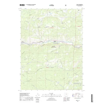
2019 Map of Rustic
USGS Topo · Published 2019About this map
The Cache la Poudre River and its designated Wild and Scenic River corridor anchor this mountain landscape, which is largely contained within the Roosevelt National Forest. Settlement patterns are concentrated along the river valley at Glen Echo, Rustic, and Indian Meadows, where the Poudre Canyon Chapel Columbarium serves the local community. The map reveals a high density of commemorative and burial sites for a mountain region, including the Manhattan Cem, Fairkytes Cem, and the Great Stupa Cem.
Find a feature on this map
53 named features on this map. Tap any name to fly to it.
Don’t see what you’re looking for? This feature index may not catch every label — zoom into the map to look around manually.
Map Details
Editions of this 2019 Rustic Map
This is the sole edition of this map. No revisions or reprints were ever made.
Other maps of this area

1907 · Livermore
USGS Topo · 1:125,000

1909 · Livermore
USGS Topo · 1:125,000

1916 · Home
USGS Topo · 1:125,000

1920 · Home
USGS Topo · 1:125,000

1954 · Greeley
USGS Topo · 1:250,000

1957 · Greeley
USGS Topo · 1:250,000

1958 · Greeley
USGS Topo · 1:250,000

1960 · Haystack Gulch
USGS Topo · 1:24,000

1961 · Greeley
USGS Topo · 1:250,000
1962 · Pingree Park
USGS Topo · 1:24,000