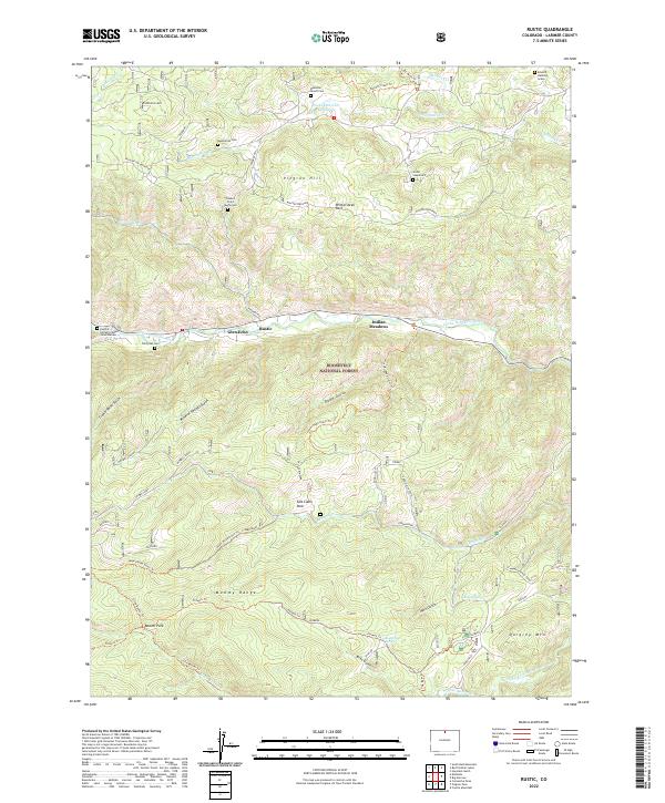
2022 Map of Rustic
USGS Topo · Published 2022About this map
Roosevelt National Forest surrounds the narrow corridor of the Cache la Poudre Wild and Scenic River, where small communities like Rustic and Glen Echo line the canyon floor. This landscape reflects a history of high-country ranching and mining, marked by the presence of Magnetite and Feldspar deposits on the southern slopes of Mineral Ridge. The map is particularly notable for its variety of burial sites and memorials, including the Manhattan Cem, the Great Stupa Cem, and the lone Edward Halliday Grave near the northern boundary. Diverse land uses are evident in the transition from wilderness areas like the Mummy Range to developed spots such as Indian Meadows. A network of historic routes, from the Upper Dadd Gulch Trl to the Flowers Trl, underscores the area's long-standing importance for both resource extraction and mountain passage.
Find a feature on this map
57 named features on this map. Tap any name to fly to it.
Don’t see what you’re looking for? This feature index may not catch every label — zoom into the map to look around manually.
Map Details
Editions of this 2022 Rustic Map
This is the sole edition of this map. No revisions or reprints were ever made.
Other maps of this area

1907 · Livermore
USGS Topo · 1:125,000

1909 · Livermore
USGS Topo · 1:125,000

1916 · Home
USGS Topo · 1:125,000

1920 · Home
USGS Topo · 1:125,000

1954 · Greeley
USGS Topo · 1:250,000

1957 · Greeley
USGS Topo · 1:250,000

1958 · Greeley
USGS Topo · 1:250,000

1960 · Haystack Gulch
USGS Topo · 1:24,000

1961 · Greeley
USGS Topo · 1:250,000
1962 · Pingree Park
USGS Topo · 1:24,000