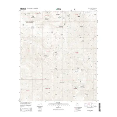
2014 Map of Rustler Park
USGS Topo · Published 2014About this map
Hilltop stands at the northern edge of this high-elevation survey, overlooking a landscape defined by the drainage networks of the Chiricahua Mountains. Most of the terrain is protected within the Chiricahua National Monument and Coronado National Forest, where a series of mountain saddles and passes like Onion Saddle and Hands Pass connect the rugged peaks. The presence of the Kasper Tunnel near the settlement of Hilltop suggests the area's legacy of subsurface exploration, while numerous high-altitude basins such as Rustler Park, Barfoot Park, and Long Park indicate the importance of these mountain meadows for forest access and recreation. A network of vital water sources, including Riggs Spring, Iron Spring, and Onion Spring, are scattered throughout the canyons, providing the essential infrastructure for movement through this high desert range.
Find a feature on this map
76 named features on this map. Tap any name to fly to it.
Don’t see what you’re looking for? This feature index may not catch every label — zoom into the map to look around manually.
Map Details
Editions of this 2014 Rustler Park Map
This is the sole edition of this map. No revisions or reprints were ever made.
Other maps of this area
1917 · San Simon
USGS Topo · 1:125,000
1917 · Chiricahua
USGS Topo · 1:125,000
1919 · Chiricahua
USGS Topo · 1:125,000
1926 · Cochise Head
USGS Topo · 1:62,500
1926 · Rodeo
USGS Topo · 1:62,500
1926 · Rucker
USGS Topo · 1:62,500
1928 · Chenoweth
USGS Topo · 1:62,500
1950 · Cochise Head
USGS Topo · 1:62,500
1950 · Vanar
USGS Topo · 1:62,500
1951 · Vanar
USGS Topo · 1:62,500