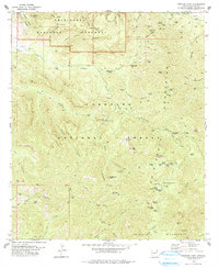
1978 Map of Rustler Park
USGS Topo · Published 1978About this map
The high ridges and canyons of the Chiricahua Mountains dominate this landscape, which in the late 1970s served as a hub for both conservation and resource extraction. Within the Coronado National Forest, the map reveals a history of prospecting at the Silver Prince Mine and El Tigre Mine, while the northern portion is protected by the Chiricahua National Monument. This area is defined by its verticality, with lookouts and stations monitoring the canyons, including the Barfoot Lookout and a Forest Service Station near Rustler Park.
Find a feature on this map
96 named features on this map. Tap any name to fly to it.
Don’t see what you’re looking for? This feature index may not catch every label — zoom into the map to look around manually.
Map Details
Editions of this 1978 Rustler Park Map
2 editions found
Other maps of this area

1917 · San Simon
USGS Topo · 1:125,000

1917 · Chiricahua
USGS Topo · 1:125,000

1919 · Chiricahua
USGS Topo · 1:125,000

1926 · Cochise Head
USGS Topo · 1:62,500

1926 · Rodeo
USGS Topo · 1:62,500

1926 · Rucker
USGS Topo · 1:62,500

1928 · Chenoweth
USGS Topo · 1:62,500

1950 · Cochise Head
USGS Topo · 1:62,500

1950 · Vanar
USGS Topo · 1:62,500

1951 · Vanar
USGS Topo · 1:62,500