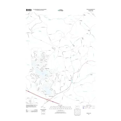
2013 Map of Sabula
USGS Topo · Published 2013About this map
Treasure Lake and its surrounding residential development dominate the western landscape of this Clearfield County survey, centered around the large water body and its smaller neighbor, Lake Sabula. This mid-2010s geography illustrates the contrast between the dense, planned street networks of the lake community and the older, sparse settlements of the Allegheny Plateau. To the east, the village of Sabula sits along the banks of Sandy Lick Cr, while the remote high ground of Boone Mountain is marked by the Boone Mountain Fire Tower. This era shows a region transitioning from its industrial and rural roots toward recreation and residential clusters. Traces of the local genealogy and land use are visible in family-named landmarks like Lambskin Hollow and Pete Buck Hollow, as well as the namesake settlement of Narrows Creek near the southern boundary.
Find a feature on this map
170 named features on this map. Tap any name to fly to it.
Don’t see what you’re looking for? This feature index may not catch every label — zoom into the map to look around manually.
Map Details
Editions of this 2013 Sabula Map
This is the sole edition of this map. No revisions or reprints were ever made.
Other maps of this area

1922 · Du Bois
USGS Topo · 1:62,500

1924 · Du Bois
USGS Topo · 1:62,500

1929 · Penfield
USGS Topo · 1:62,500

1932 · Penfield
USGS Topo · 1:62,500

1940 · Hallton
USGS Topo · 1:48,000

1941 · Ridgway
USGS Topo · 1:62,500

1943 · Hallton
USGS Topo · 1:62,500

1944 · Du Bois
USGS Topo · 1:62,500

1944 · Ridgway
USGS Topo · 1:62,500

1957 · Warren
USGS Topo · 1:250,000