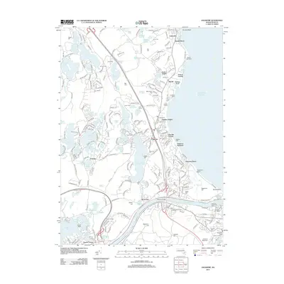
2012 Map of Sagamore
USGS Topo · Published 2012About this map
The Cape Cod Canal serves as the focal point of this coastal landscape, bisecting the terrain where the Atlantic shoreline meets the interior ponds of Plymouth. The engineering of the Sagamore Bridge and Sagamore Bridge Conn facilitates transit across the waterway, while the Cape Cod Canal Range Light and Sandwich Marina mark the maritime industry at the eastern entrance. The map reveals a dense concentration of freshwater bodies, including Great Herring Pond and Bloody Pond, which are surrounded by numerous summer camps such as Camp Massasoit and Camp Clark.
Find a feature on this map
105 named features on this map. Tap any name to fly to it.
Don’t see what you’re looking for? This feature index may not catch every label — zoom into the map to look around manually.
Map Details
Editions of this 2012 Sagamore Map
This is the sole edition of this map. No revisions or reprints were ever made.
Other maps of this area

1886 · Falmouth
USGS Topo · 1:62,500

1886 · Plymouth
USGS Topo · 1:62,500

1888 · Barnstable
USGS Topo · 1:62,500

1888 · Falmouth
USGS Topo · 1:62,500

1889 · Plymouth
USGS Topo · 1:62,500

1893 · Barnstable
USGS Topo · 1:62,500

1893 · Falmouth
USGS Topo · 1:62,500

1894 · Plymouth
USGS Topo · 1:62,500

1915 · Falmouth
USGS Topo · 1:62,500

1920 · Falmouth
USGS Topo · 1:62,500