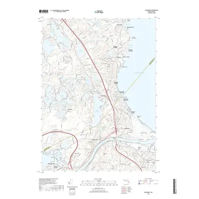
2018 Map of Sagamore
USGS Topo · Published 2018About this map
The Sagamore Bridge and Bourne Bridge span the Cape Cod Canal, connecting the mainland to the coastal communities of Barnstable County. This 2018 survey documents a landscape defined by glacial kettle ponds and a rugged Atlantic shoreline, where maritime history meets modern infrastructure. Along the coast, settlements like Sagamore Beach, Ellisville, and Vallersville dot the bluffs above Bayside Beach. Interior terrain is characterized by numerous water bodies including Great Herring Pond, Long Pond, and Bloody Pond, often interspersed with commercial cranberry operations like Mountain Hill Bogs. Genealogists will find significant value in the mapped locations of Saddle and Pilgrim Graves and several local burying grounds, such as Savery Cem and Cedarville Cem. The corridor is further unified by the Cape Cod Central RR, which mirrors the canal's path past Bournedale and the heights of Sagamore Highlands.
Find a feature on this map
223 named features on this map. Tap any name to fly to it.
Don’t see what you’re looking for? This feature index may not catch every label — zoom into the map to look around manually.
Map Details
Editions of this 2018 Sagamore Map
This is the sole edition of this map. No revisions or reprints were ever made.
Other maps of this area

1886 · Falmouth
USGS Topo · 1:62,500

1886 · Plymouth
USGS Topo · 1:62,500

1888 · Barnstable
USGS Topo · 1:62,500

1888 · Falmouth
USGS Topo · 1:62,500

1889 · Plymouth
USGS Topo · 1:62,500

1893 · Barnstable
USGS Topo · 1:62,500

1893 · Falmouth
USGS Topo · 1:62,500

1894 · Plymouth
USGS Topo · 1:62,500

1915 · Falmouth
USGS Topo · 1:62,500

1920 · Falmouth
USGS Topo · 1:62,500