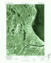
1977 Map of Sagamore
USGS Topo · Published 1981About this map
The Cape Cod Canal serves as the dominant industrial and geographical feature on this 1977 orthophotoquad, cutting across the landscape to connect the surrounding waters. Unlike a traditional topographic map, this aerial perspective reveals the dense vegetation and residential development patterns as they stood in the late 1970s. The settlement of Sagamore and the neighboring Sandwich are visible at the canal's eastern entrance, highlighting the area's strategic maritime importance.
Find a feature on this map
11 named features on this map. Tap any name to fly to it.
Don’t see what you’re looking for? This feature index may not catch every label — zoom into the map to look around manually.
Map Details
Editions of this 1977 Sagamore Map
This is the sole edition of this map. No revisions or reprints were ever made.
Other maps of this area

1886 · Falmouth
USGS Topo · 1:62,500

1886 · Plymouth
USGS Topo · 1:62,500

1888 · Barnstable
USGS Topo · 1:62,500

1888 · Falmouth
USGS Topo · 1:62,500

1889 · Plymouth
USGS Topo · 1:62,500

1893 · Barnstable
USGS Topo · 1:62,500

1893 · Falmouth
USGS Topo · 1:62,500

1894 · Plymouth
USGS Topo · 1:62,500

1915 · Falmouth
USGS Topo · 1:62,500

1920 · Falmouth
USGS Topo · 1:62,500