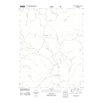
2011 Map of Saguache Park
USGS Topo · Published 2011About this map
Saguache Park and the surrounding Cochetopa Hills define the high-altitude landscape of this 2011 survey. The region is a complex watershed where numerous tributaries, including North Fork Saguache Creek, Middle Fork Saguache Creek, and Ant Creek, converge to form the upper reaches of Saguache Creek. This map reveals a terrain deeply etched by seasonal water and geological formations, most notably at Chimney Rock and the adjacent Chimney Rock Gulch. Human presence is marked primarily by forest access routes like Co RD 17 Aa and the Stone Cellar Campground, suggesting a landscape dedicated to recreation and resource management rather than permanent settlement. Names like Miners Creek and Camp Gulch provide linguistic clues to the area's historical prospecting and temporary encampments, while the various forks of the creek illustrate the intricate drainage patterns of the Colorado high country.
Find a feature on this map
25 named features on this map. Tap any name to fly to it.
Don’t see what you’re looking for? This feature index may not catch every label — zoom into the map to look around manually.
Map Details
Editions of this 2011 Saguache Park Map
This is the sole edition of this map. No revisions or reprints were ever made.
Other maps of this area

1914 · Creede
USGS Topo · 1:125,000

1916 · Creede
USGS Topo · 1:125,000

1945 · Durango
USGS Topo · 1:250,000

1953 · Durango
USGS Topo · 1:250,000

1954 · Durango
USGS Topo · 1:250,000

1956 · Montrose
USGS Topo · 1:250,000

1959 · Montrose
USGS Topo · 1:250,000

1959 · Creede
USGS Topo · 1:62,500

1960 · Montrose
USGS Topo · 1:250,000

1961 · Durango
USGS Topo · 1:250,000