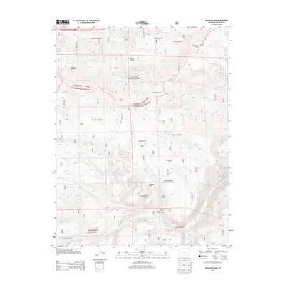
2013 Map of Saguache Park
USGS Topo · Published 2013About this map
Saguache Park sits at a high-elevation crossroads where the Gunnison and Rio Grande National Forests meet along the Cochetopa Hills. This 2013 survey details a landscape defined by the drainage basins of the Saguache Creek system, including the Middle Fork and North Fork. The map highlights the intersection of modern recreational infrastructure with the enduring geography of the Continental Divide, specifically tracing the Continental Divide National Scenic Trail. For researchers of Colorado's backcountry, the map provides precise locations for named landmarks like Chimney Rock and Rincon Quemado, alongside the established Stone Cellar Campground. The presence of several US Forest Service routes, such as Lake Fork Trail 785, reflects the managed transition from wilderness gulches to modern access corridors.
Find a feature on this map
41 named features on this map. Tap any name to fly to it.
Don’t see what you’re looking for? This feature index may not catch every label — zoom into the map to look around manually.
Map Details
Editions of this 2013 Saguache Park Map
This is the sole edition of this map. No revisions or reprints were ever made.
Other maps of this area

1914 · Creede
USGS Topo · 1:125,000

1916 · Creede
USGS Topo · 1:125,000

1945 · Durango
USGS Topo · 1:250,000

1953 · Durango
USGS Topo · 1:250,000

1954 · Durango
USGS Topo · 1:250,000

1956 · Montrose
USGS Topo · 1:250,000

1959 · Montrose
USGS Topo · 1:250,000

1959 · Creede
USGS Topo · 1:62,500

1960 · Montrose
USGS Topo · 1:250,000

1961 · Durango
USGS Topo · 1:250,000