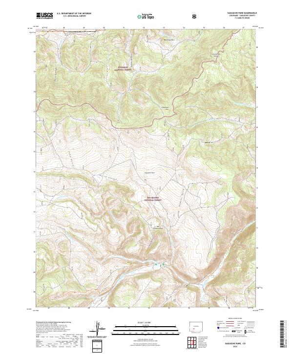
2022 Map of Saguache Park
USGS Topo · Published 2022About this map
Gunnison National Forest and Rio Grande National Forest converge in this high-altitude landscape, where the Continental Divide forms a significant topographic boundary. This 2022 survey captures the headwaters of the Saguache Cr system, including its north, middle, and south forks. The area is defined by massive open spaces like Saguache Park and Monchego Park, alongside prominent landforms such as Chimney Rock and the Cochetopa Hills. Movement through this high country is primarily facilitated by a network of established paths rather than modern roads, notably the Continental Divide National Scenic Trl, which traverses the northern reaches of the quadrangle. Other routes like the Saguache Creek Trl and Lake Fork Trl follow the natural drainages of the Mexican Joe Gulch and Hawkins Gulch, highlighting the area's preservation as a wilderness and recreational corridor.
Find a feature on this map
34 named features on this map. Tap any name to fly to it.
Don’t see what you’re looking for? This feature index may not catch every label — zoom into the map to look around manually.
Map Details
Editions of this 2022 Saguache Park Map
This is the sole edition of this map. No revisions or reprints were ever made.
Other maps of this area

1914 · Creede
USGS Topo · 1:125,000

1916 · Creede
USGS Topo · 1:125,000

1945 · Durango
USGS Topo · 1:250,000

1953 · Durango
USGS Topo · 1:250,000

1954 · Durango
USGS Topo · 1:250,000

1956 · Montrose
USGS Topo · 1:250,000

1959 · Montrose
USGS Topo · 1:250,000

1959 · Creede
USGS Topo · 1:62,500

1960 · Montrose
USGS Topo · 1:250,000

1961 · Durango
USGS Topo · 1:250,000