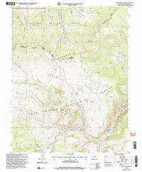
2001 Map of Saguache Park
USGS Topo · Published 2005About this map
The Continental Divide winds across the high terrain of Saguache County, forming the boundary between the Gunnison National Forest and Rio Grande National Forest. This remote landscape is defined by the Cochetopa Hills and the broad expanse of Saguache Park, where a network of 4WD trails provides the only access into the high timber and mountain meadows. Small, isolated outposts such as Salt House and Stone Cellar are situated near the headwaters of vital drainage systems.
Find a feature on this map
35 named features on this map. Tap any name to fly to it.
Don’t see what you’re looking for? This feature index may not catch every label — zoom into the map to look around manually.
Map Details
Editions of this 2001 Saguache Park Map
This is the sole edition of this map. No revisions or reprints were ever made.
Other maps of this area

1914 · Creede
USGS Topo · 1:125,000

1916 · Creede
USGS Topo · 1:125,000

1945 · Durango
USGS Topo · 1:250,000

1953 · Durango
USGS Topo · 1:250,000

1954 · Durango
USGS Topo · 1:250,000

1956 · Montrose
USGS Topo · 1:250,000

1959 · Montrose
USGS Topo · 1:250,000

1959 · Creede
USGS Topo · 1:62,500

1960 · Montrose
USGS Topo · 1:250,000

1961 · Durango
USGS Topo · 1:250,000