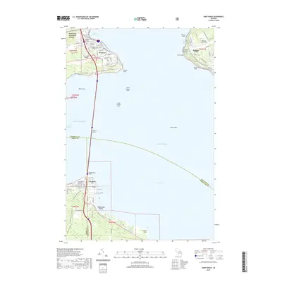
2019 Map of Saint Ignace
USGS Topo · Published 2019About this map
St. Ignace and Mackinaw City serve as the anchors for this coastal study, positioned on either side of the Straits of Mackinac. The massive span of the Mackinac Bridge connects the Upper and Lower Peninsulas, a modern engineering feat that defines the local geography. On the northern shore, the Mackinac County Courthouse and Saint Ignace Loyola Catholic Cem mark the heart of the community, which is bordered by the southern reaches of the Hiawatha National Forest.
Find a feature on this map
81 named features on this map. Tap any name to fly to it.
Don’t see what you’re looking for? This feature index may not catch every label — zoom into the map to look around manually.
Map Details
Editions of this 2019 Saint Ignace Map
This is the sole edition of this map. No revisions or reprints were ever made.
Other maps of this area

1931 · St Ignace NW
USGS Topo · 1:31,680

1931 · Moran NE
USGS Topo · 1:31,680

1932 · St Ignace NE
USGS Topo · 1:31,680

1948 · Moran NE
USGS Topo · 1:31,680

1955 · Cheboygan
USGS Topo · 1:250,000

1957 · Mullett Lake
USGS Topo · 1:62,500

1958 · Cheboygan
USGS Topo · 1:250,000

1958 · Pellston
USGS Topo · 1:62,500
1964 · Moran
USGS Topo · 1:24,000

1964 · Round Island
USGS Topo · 1:24,000
Featured Places
- Saint Ignace, MI
- Mackinaw City, MI
- Mackinac Island, MI
- Edgewater Beach, Mackinaw City
- Wawatam Township, MI