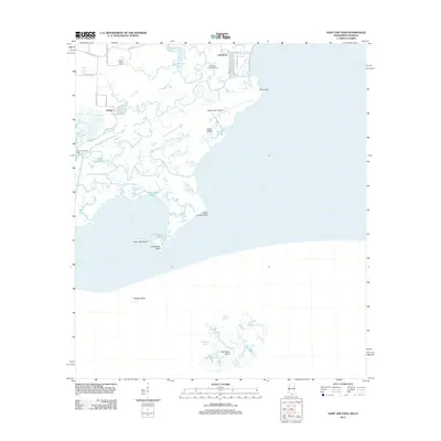
2012 Map of Saint Joe Pass
USGS Topo · Published 2012About this map
Lakeshore and the neighboring settlement of Ansley sit at the edge of a complex marshland where the Mississippi coastline begins its transition into the deltaic landscape. This 2012 survey illustrates the intricate network of waterways defining the area, including Three Oaks Bayou, Redfish Bayou, and Heron Bay Bayou, which drain into the expansive Heron Bay. Local history and genealogy interests are anchored by the Bayou Caddy Cem and landmarks such as Lighthouse Point and Saint Joseph Point. The map also documents a recreational landscape of fishing camps, specifically Bordage Fishing Camp and LaFrance Fishing Camp, scattered along the coastal fringe. To the south, isolated landforms like Half Moon Island and Grassy Island emerge from the sound, marking the outer limits of the state's coastal marshes.
Find a feature on this map
46 named features on this map. Tap any name to fly to it.
Don’t see what you’re looking for? This feature index may not catch every label — zoom into the map to look around manually.
Map Details
Editions of this 2012 Saint Joe Pass Map
This is the sole edition of this map. No revisions or reprints were ever made.
Other maps of this area

1893 · Rigolets
USGS Topo · 1:62,500

1893 · Toulme
USGS Topo · 1:62,500

1914 · Nicholson
USGS Topo · 1:62,500

1921 · Nicholson
USGS Topo · 1:62,500

1935 · English Lookout
USGS Topo · 1:31,680

1935 · Grand Island Pass
USGS Topo · 1:31,680

1936 · Rigolets
USGS Topo · 1:62,500

1946 · Malheureux Point
USGS Topo · 1:31,680

1949 · Grand Island Pass
USGS Topo · 1:31,680
1949 · False Mouth Bayou
USGS Topo · 1:31,680