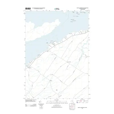
2013 Map of Saint Lawrence
USGS Topo · Published 2013About this map
Saint Lawrence River shorelines and the rural interior of Jefferson County define this northern New York landscape. The map centers on the small hamlet of Saint Lawrence and the nearby settlement of Warren, where a network of county routes such as Co Rte-4 and Co Rte-8 connect inland farms to the riverfront. Navigation and recreation are central to the area's character, evidenced by the presence of Gull Rock Light and the extensive grounds of Cedar Point State Park at the river's edge.
Find a feature on this map
62 named features on this map. Tap any name to fly to it.
Don’t see what you’re looking for? This feature index may not catch every label — zoom into the map to look around manually.
Map Details
Editions of this 2013 Saint Lawrence Map
This is the sole edition of this map. No revisions or reprints were ever made.
Other maps of this area

1895 · Cape Vincent
USGS Topo · 1:62,500

1900 · Clayton
USGS Topo · 1:62,500

1903 · Grindstone
USGS Topo · 1:62,500

1903 · Clayton
USGS Topo · 1:62,500

1942 · Cape Vincent North
USGS Topo · 1:31,680

1942 · Chaumont
USGS Topo · 1:31,680

1942 · Sawmill Bay
USGS Topo · 1:31,680

1942 · Cape Vincent South
USGS Topo · 1:31,680

1942 · Clayton
USGS Topo · 1:24,000
1943 · Dexter
USGS Topo · 1:31,680