2023 Map of Salem
USGS Topo · Published 2023About this map
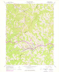
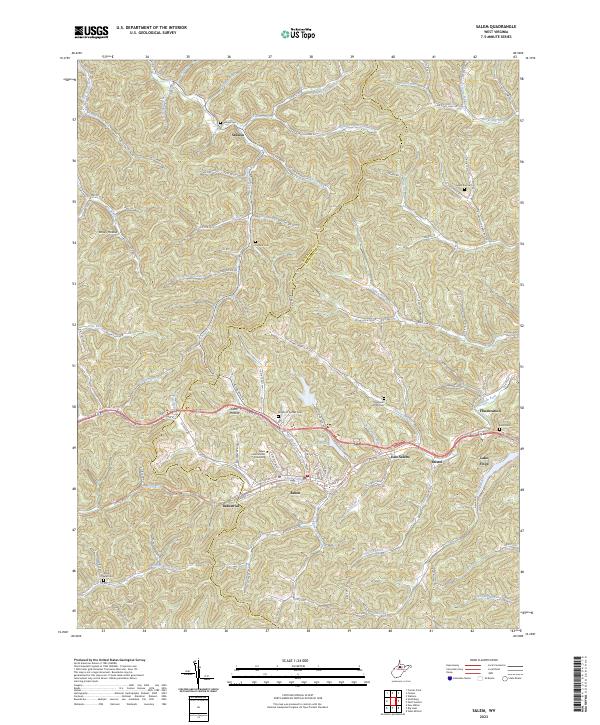
The town of Salem serves as the focal point of this Harrison County landscape, where the campus of Salem International University and the historic corridor of the North Bend Rail-Trl intersect. The terrain is defined by a dense network of steep hollows and runs, including the uniquely named Bear Attack Run and Raccoon Run. Settlement patterns follow the valley floors, with the communities of Industrial, East Salem, and Bristol clustered along the southern transit corridor near the City Reservoir. In the northern reaches, smaller hamlets like Sedalia and Flinderation are situated among family-named landmarks such as Sedalia Cem and the Knight of Pythias Cem. To the east, the recreational waters of Lake Floyd provide a distinct contrast to the surrounding ridges, illustrating the transition from traditional Appalachian valley settlements to modern residential developments.
Find a feature on this map
75 named features on this map. Tap any name to fly to it.
Don’t see what you’re looking for? This feature index may not catch every label — zoom into the map to look around manually.
Map Details
Editions of this 2023 Salem Map
This is the sole edition of this map. No revisions or reprints were ever made.