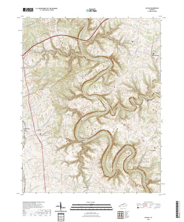
2022 Map of Salvisa
USGS Topo · Published 2022About this map
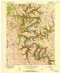
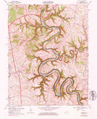
The Kentucky River carves a deep, serpentine path through this landscape, marking the historic boundaries of Mercer, Anderson, and Woodford Counties. This portion of the Bluegrass region is defined by these dramatic river meanders, including the sharp turn at Oregon Bend and the looping Chapman Bend. The settlement pattern follows the high ground between the river's limestone bluffs, with established communities like Salvisa and Mortonsville serving as local hubs. For genealogists, the map is a vital record of family landmarks, preserving the locations of numerous small burial grounds such as Morris Cem, Hawkins Cem, and The Polk Memorial Church Cem. The terrain is further etched by smaller waterways like Bailey Run and Clear Creek, while the rural road network, including historic routes like McCowans Ferry Rd and Scotts Ferry Rd, suggests the importance of early river crossings to the local economy.
Find a feature on this map
79 named features on this map. Tap any name to fly to it.
Don’t see what you’re looking for? This feature index may not catch every label — zoom into the map to look around manually.
Map Details
Editions of this 2022 Salvisa Map
This is the sole edition of this map. No revisions or reprints were ever made.