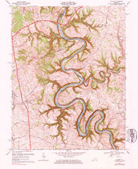
1967 Map of Salvisa
USGS Topo · Published 1984About this map
The Kentucky River snakes in sharp, hairpin meanders through the central terrain of this 1960s survey, serving as the primary geographic divider between Anderson, Woodford, and Mercer Counties. The landscape is defined by these deep river bends and the numerous creeks that feed them, including Gilbert Creek, Clear Creek, and Grier Creek. While the Blue Grass Parkway cuts a modern path across the northern reaches, the interior remains a network of secondary routes like Scotts Ferry Road and Lillards Ferry Road, reflecting an older river-oriented economy.
Find a feature on this map
61 named features on this map. Tap any name to fly to it.
Don’t see what you’re looking for? This feature index may not catch every label — zoom into the map to look around manually.
Map Details
Editions of this 1967 Salvisa Map
2 editions found
Other maps of this area

1905 · Harrodsburg
USGS Topo · 1:125,000

1906 · Georgetown
USGS Topo · 1:62,500

1908 · Georgetown
USGS Topo · 1:62,500

1922 · Frankfort
USGS Topo · 1:48,000

1924 · Frankfort
USGS Topo · 1:62,500

1951 · Lawrenceburg
USGS Topo · 1:24,000

1952 · Keene
USGS Topo · 1:24,000

1952 · Harrodsburg
USGS Topo · 1:24,000

1952 · Cornishville
USGS Topo · 1:24,000

1952 · Salvisa
USGS Topo · 1:24,000