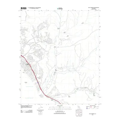
2012 Map of San Clemente
USGS Topo · Published 2012About this map
The coastal community of San Clemente sits at the heart of this Southern California shoreline, where suburban expansion meets the protected landscapes of the Santa Ana Mountains. The geography is defined by a series of dramatic incisions into the coastal terrace, including Cristianitos Canyon, Talega Canyon, and San Mateo Canyon, through which seasonal waterways like Cristianitos Cr flow toward the Pacific Ocean. Along the surf, the iconic San Clemente Pier and the renowned surfing grounds at Trestles Beach mark the transition from urban infrastructure to the more open spaces near San Mateo Point.
Find a feature on this map
86 named features on this map. Tap any name to fly to it.
Don’t see what you’re looking for? This feature index may not catch every label — zoom into the map to look around manually.
Map Details
Editions of this 2012 San Clemente Map
This is the sole edition of this map. No revisions or reprints were ever made.
Other maps of this area

1901 · Southern California Sheet No. 1
USGS Topo · 1:250,000

1901 · Elsinore
USGS Topo · 1:125,000

1901 · San Luis Rey
USGS Topo · 1:125,000

1902 · Capistrano
USGS Topo · 1:125,000

1902 · Corona
USGS Topo · 1:125,000

1904 · Southern California Sheet No. 2
USGS Topo · 1:250,000

1904 · Southern California Sheet No. 1
USGS Topo · 1:250,000

1906 · Capistrano
USGS Topo · 1:125,000

1941 · Margarita Peak
USGS Topo · 1:62,500

1942 · Lake Elsinore
USGS Topo · 1:62,500
Featured Places
- San Clemente, CA
- San Juan Capistrano, CA
- San Onofre, Marine Corps Base Camp Pendleton
- Marine Corps Base Camp Pendleton, CA
- San Diego County, CA