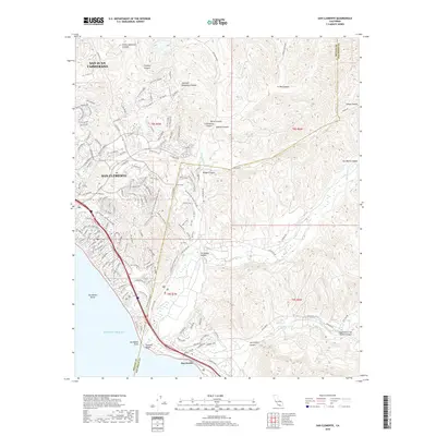
2018 Map of San Clemente
USGS Topo · Published 2018About this map
San Clemente sits at the intersection of complex coastal canyons and modern infrastructure, shown here in a recent era of development. The map details the transition from the densely residential neighborhoods of San Juan Capistrano and the coastal bluffs to the undeveloped drainage systems of the Santa Ana Mountains. To the south, the landscape becomes increasingly defined by the military and environmental buffers surrounding San Onofre, where the corridor narrows between the Pacific and the steep hills. Notable transit arteries including the Metrolink rail line and the Pacific Coast Highway trace the shoreline, while the interior is a maze of named canyons such as Talega Canyon and San Mateo Canyon. The jurisdictional boundary between Orange and San Diego counties cuts through this rugged terrain, marking a distinct shift in land use from the urbanized northern sectors to the open expanses above San Mateo Point.
Find a feature on this map
158 named features on this map. Tap any name to fly to it.
Don’t see what you’re looking for? This feature index may not catch every label — zoom into the map to look around manually.
Map Details
Editions of this 2018 San Clemente Map
This is the sole edition of this map. No revisions or reprints were ever made.
Other maps of this area

1901 · Southern California Sheet No. 1
USGS Topo · 1:250,000

1901 · Elsinore
USGS Topo · 1:125,000

1901 · San Luis Rey
USGS Topo · 1:125,000

1902 · Capistrano
USGS Topo · 1:125,000

1902 · Corona
USGS Topo · 1:125,000

1904 · Southern California Sheet No. 2
USGS Topo · 1:250,000

1904 · Southern California Sheet No. 1
USGS Topo · 1:250,000

1906 · Capistrano
USGS Topo · 1:125,000

1941 · Margarita Peak
USGS Topo · 1:62,500

1942 · Lake Elsinore
USGS Topo · 1:62,500
Featured Places
- San Clemente, CA
- San Juan Capistrano, CA
- San Onofre, Marine Corps Base Camp Pendleton
- Marine Corps Base Camp Pendleton, CA
- San Diego County, CA